Tuesday, 9 January 2024

River Granta in flood

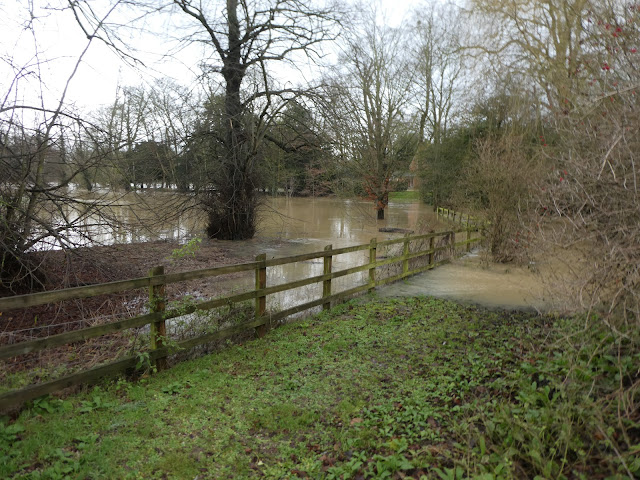
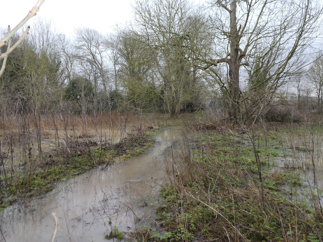
2nd - 5th January 2024. As many will have realised, some perhaps to their cost, the recent heavy rain dramatically raised the level of the River Granta in the village.  Initially, on the 2nd January, the river was running very high in its bed, but the water on Hood's Meadow seemed to just be the result of the heavy rain. However, over the course of 5th January, the river level rose dramatically, flooding the Cricket Field, the area upstream of the road bridge, and both Sluice Wood and Cook's Meadow.

Photos from Derek T (2nd Jan) and David F (5th Jan).

2nd Jan - river running high, but still in its bed - just!

2nd Jan - flooding on Hood's Meadow, but likely to be collected rain, 
rather than the river bursting its banks

5th Jan - flooding of the Cricket Field

5th Jan - looking upstream, from the road bridge

5th Jan - the Recreation Ground from the Millennium Bridge

5th Jan - Sluice Wood, looking downstream towards the old footbridge

5th Jan - Cook's Meadow

5th Jan - just downstream of the Sluice from the GP side

No comments:

The Aims of Abington Naturewatch

At their meeting on 9 April 2005 the members approved this revised version of the aims of Abington Naturewatch:

  • To monitor and record the wildlife (fauna & flora) within the borders of the Abingtons;
  • To encourage protection of our wildlife, maintain its quality and foster its diversity;
  • To promote awareness of the richness, potential and problems of the natural environment of the Abingtons;
  • To cooperate in improving access to the local natural environment for the benefit of all Abington villagers.

Pat Daunt, Founder

The organisation is informal and communication is by email if possible; members are notified of events from time to time. Contact details are maintained by a small "project team". There is currently no membership fee as costs are covered by voluntary contributions at events.

Members are encouraged to report notable sightings of flora and fauna within the Abingtons to the appropriate sector coordinator and an illustrated record is published annually.

A map of the area covered, with some features noted, is available here: http://maps.google.co.uk/maps/ms?ie=UTF8&hl=en&msa=0&msid=213774935674882866424.00000111dca2be9f06ab8&z=13>

For more information or to join, please contact David Farrant on (01223) 892871.

Contributions to our records should be sent to sector contacts or either of the above. Photographs may also be submitted to Andy Merryweather (amerryweather61@gmail.com)